

18 mars 2012
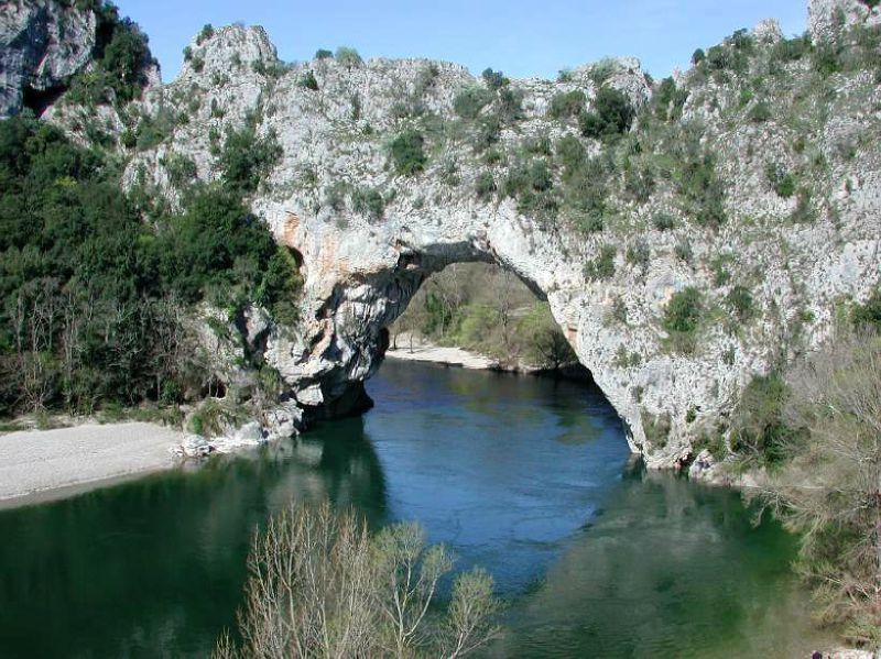
GORGES DE L'ARDECHE
http://www.calculitineraires.fr/serviceweb/carteweb.php?id=175668&zoom=11&type=G_PHYSICAL_MAP" frameborder="0" scrolling="no" type="text/html">
distance 101 kms
depart : 97 m
dénivelé positif : 1596 m
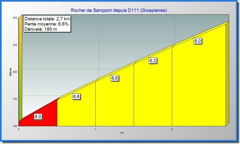
départ de ruoms en suivant les gorges jusqu'a Saint-martin-d'ardèche puis direction Orgnac-l'aven , après Bessas passage du col de serre ( 356m) et retour par le rocher de sampzon
COL DE LA SERRE


/https%3A%2F%2Fstorage.canalblog.com%2F60%2F25%2F965920%2F74791443_o.jpg)
/https%3A%2F%2Fassets.over-blog.com%2Ft%2Fcedistic%2Fcamera.png)
/https%3A%2F%2Fstorage.canalblog.com%2F49%2F36%2F965920%2F74155982_o.jpg)
/https%3A%2F%2Fstorage.canalblog.com%2F84%2F04%2F965920%2F74606644_o.jpg)
Publicité
Publicité
Commentaires